
On a clear day, the Scarborough Bluffs and the Toronto Islands are the two places Torontonians flock to most. They feel like separate worlds: the Islands require a ferry ride, while the Bluffs feel “tucked away”, accessible only through winding roads and hidden entrances that create the sensation of stumbling into a secluded wilderness.
But at dawn, before midday crowds transform these quiet retreats into busy city extensions, an older connection becomes perceptible. Despite their distance, the Islands are essentially the Bluffs in another form: the physical afterlife of the cliffs, carried westward by the slow, persistent movement of the lake.
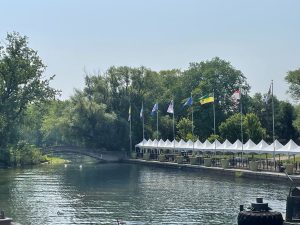
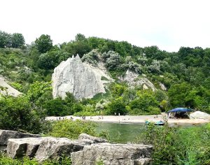
The Earth That Traveled West
The Toronto Islands and the Scarborough Bluffs are not separate geological features, but two ends of the same process. The Islands were never meant to be islands. They began as a long, narrow peninsula of sandbars, assembled slowly as waves eroded the face of the Bluffs. Grain by grain, sediment was carried westward by lake currents and deposited just beyond the harbor mouth, forming land that did not stay where it originated.
The Bluffs themselves function as a vertical record of the late Ice Age. They mark the former shoreline of Lake Iroquois, a glacial lake that once stood far higher than today’s Lake Ontario. Over roughly 70,000 years, advancing and retreating ice laid down distinct layers of clay, sand, and till. Rising nearly 90 meters above the lake today, these exposed strata make Toronto’s deep geological past visible at the surface.
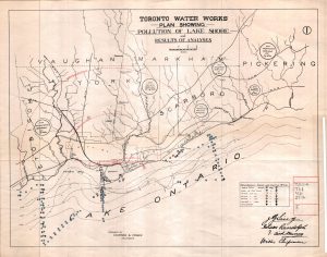
A Glimpse of Home
In 1793, Elizabeth Simcoe, the wife of Upper Canada’s first Lieutenant Governor, rowed eastward from the settlement of York. In her diary, she noted that the pale, towering cliffs reminded her of the white chalk coastline of Scarborough in Yorkshire, England. By 1796, the name “Scarborough” was officially adopted, forever linking a Toronto township to the English seaside.
From the late eighteenth century into the nineteenth, this stretch of shoreline was as dangerous as it was beautiful. Before modern navigation systems, ships frequently wrecked in the fog and storms offshore. Over time, a pragmatic salvage culture emerged: when cargo washed ashore, local families claimed what the lake had released.
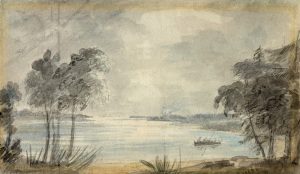
The Storm of 1858
Lady Simcoe also spent time on what she described as “the peninsula opposite Toronto”, which are today’s Toronto Islands. She described a wild landscape of natural meadows, scattered ponds, and a tangle of wild vines and flowers. For decades, this peninsula stretched from today’s Cherry Beach, hugging the shoreline.
Everything changed in the spring of 1858. A violent April storm hammered the city, with massive waves breaching the narrowest part of the peninsula. Water surged through the opening, carving out what we now call the Eastern Gap. While a smaller storm had created a temporary breach six years earlier, the 1858 gap was permanent. Nature had officially severed the land, turning the peninsula into a chain of islands.
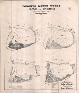
What first appeared as a natural disaster quietly reshaped the city’s future. That jagged breach torn by the storm became the most vital shipping channel for Toronto’s harbor, an accidental piece of infrastructure that still defines the harbor today.
Standing on the Bluffs or the Islands today places visitors at opposite ends of the same landscape process. Toronto, in this sense, is not a static place, but a city continually shaped by water.
—
Further Reading
Toronto’s Lost Villages – Ron Brown. Toronto: Dundurn Press, 2020 (originally published by Polar Bear Press, 1997).
“Exploring the Scarborough Bluffs on Lake Ontario,” Reader’s Digest Canada, Feb 11, 2021. https://www.readersdigest.ca/travel/canada/scarborough-bluffs/
“10 Fascinating Facts About the Scarborough Bluffs,” Storeys (online article). https://storeys.com/scarborough-bluffs-facts/
“1878 Copps & Clark Co. Plan of the City of Toronto,” Old Toronto Maps (blog post). https://oldtorontomaps.blogspot.com/2013/01/1878-copps-clark-co-plan-of-city-of.html
“The Fires of Elizabeth Simcoe,” Toronto History (Substack article). https://torontohistory.substack.com/p/the-fires-of-elizabeth-simcoe
Painting of York Harbour by Elizabeth Simcoe — Elizabeth Simcoe (public domain), Wikimedia Commons. https://flickr.com/photos/157301177@N03/48976726148


